Easy Read Britain 2012

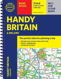
This updated road atlas provides super clear mapping at 2.3 miles to 1 inch. Static speed camera locations are pinpointed on the mapping, wide minor roads and A&E hospitals. There is a full colour county, unitary and administrative area map, route-planning map and journey planning section.

£14.99

Compare
SKU: 9780749568207 Category: Tag:

Description

A comprehensive, updated, and organized map of Britain’s roads

Each page has been titled with its geographical location so turning to the page you want is easy. Static speed camera locations with speed limits are pinpointed. Wide minor roads, National Trust, English and World Heritage sites, crematorium, and other hard-to-find places are also shown.

Additional information

Weight 1.191 kg
Dimensions 30.6 × 22.8 × 2.4 cm
Author
Publisher

Imprint

Cover

Pages

Language

Edition
Dewey

Readership